
Awed by the Dragon’s Backbone
September 1, 2013 § 2 Comments
Layers of land cascading in a step-wise fashion down the hillside. Pools of water with their reflections adding a mirror-like quality to the lush green land. The terraced paddy-fields worked by the hands of the rice farmers seem apart from the rest of bustling modern China. The Han Chinese take a back seat in the observer role to the local minority cultures present in the predominately ethnic Zhuang and Yao villages.
This is the Dragon’s Backbone.
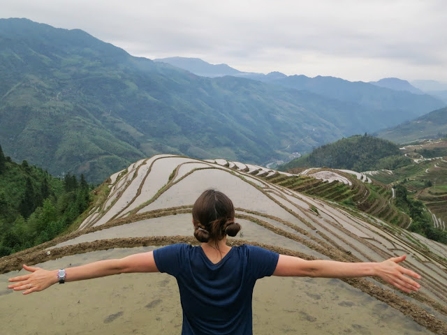

This ridge of rice terraces in the foreground is called the “Dragon’s Backbone” since it looks like a (scoliotic) spine.
A few days visit to the rice terrace fields of Guangxi province in southern China gave us some of the most unique and enjoyable views in the country.The weather was extremely pleasant, we got the opportunity to do a 4 hour hike with all of our belongings from one town over the hills of fields to the next town, and we encountered intriguing minority cultures along the way. The hostels provided excellent value (the first gave us one of the best views of the trip; the second was among the cheapest at $8 per double room), we met a few interesting travelers, but all in all the story of our time in the villages of Ping’an and Dazhai is best told through pictures.
A few snapshots are included below; we let the rest stand alone to tell the story in the full album here.

Backpacks made of baskets

View from our hostel in Dazhai
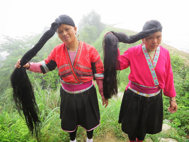
Long haired Yao ladies

Morning chores
Full photo album from our visit to the Longji (Dragon’s Backbone) Rice Terraces here.

Beautiful pictures of rice terraces and the dragon’s spine. I thought rice was grown under the water in ponds. I continue to learn through your travels.
Why are topographical maps illegal in China?
Regarding the rice, each terrace/field is flooded so it is basically a shallow pond. As best we could tell the maps are illegal unless made by the government for national security or control of information reasons.